Aim 4: To preserve the historical sites and monuments including the remaining cold war artefacts.


1) Introduction
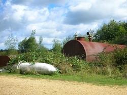
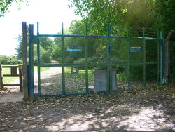
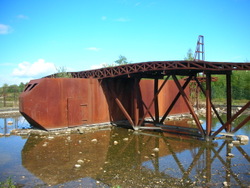
The dominant landscape and built features of the Commons that exist today relate to the area's land use history as common land and as a military airbase. The Cold War history of the area is of national significance and it is the aim of the council to restore and conserve these historical features. Although much of the infrastructure of the airbase was removed during the restoration phase in the 1990s, a large number of features have been retained including a section of the runway, stretches of fencing notably around the GAMA site (a Scheduled Monument), buildings - within the area now known as New Greenham Park (operated as a business park) and on the open common itself - a flagpole, hydrants and the fireplane.
The airfield control tower is owned by Greenham Parish Council, is not on common land, and is therefore outside the area of this management plan.

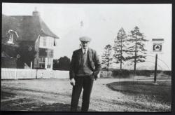
Unfortunately many earlier archaeological features were removed with the large-scale re-shaping of the landscape of the common at the start of the Second World War and subsequently. Earlier archaeological monuments do appear to have been removed during the construction of the airfield. The Ark tea room and Rifle Volunteers pub were amongst these, together with the eponymous Bury's Bank linear earthwork and some 19th century rifle butts. Any pre-Second World War monuments and artefacts that remain are therefore vital in terms of what they can tell us about the common prior to that date and back into prehistory.
A Heritage Management Plan (HEMP) has been produced (2011) for Greenham and Crookham Commons as part of the Higher Level Stewardship agreement.
In essence the plan highlights the key historic environment features surviving on the commons, and the land use practices which created and sustained them. It provides an overall assessment of any potential conflicts in the management of the historic environment features with other interests on the commons.
This will enable us to better conserve historic features on the common and to avoid any potential damage caused by other management activities or visitor pressure. It may also provide opportunities for interpretation of some of the more notable or visible features.
2) Aims and objectives (2011-2016)
- Incorporate the findings and recommendations of the Historic Environment Management Plan 2011 (HEMP) into this Management Plan. The HEMP can be downloaded as a pdf file from the Appendices page.
- Using the HEMP and West Berkshire Council's Historic Environment Record, follow the recommendations for management of each historic feature in order to conserve and enhance it, taking into account the nature conservation value of the site and the habitat management prescriptions for the relevant compartment.
- Select those historic features or any collection of related features identified in the HEMP that would aid understanding of the historic processes at work on the common. Provide some form of interpretive information on them either within planned on-site interpretation or leaflets (see Education page) or in the form of an additional interpretive panel and/or leaflet.
- Continue to promote the significance of the common in terms of its built heritage through on-site interpretation, website and events.